
Artà features 25 kilometres of unspoiled coast. Their support for a sustainable touristic model has helped to preserve it in its natural state. Therefore, we can still enjoy these wild and beautiful beaches in their natural state.
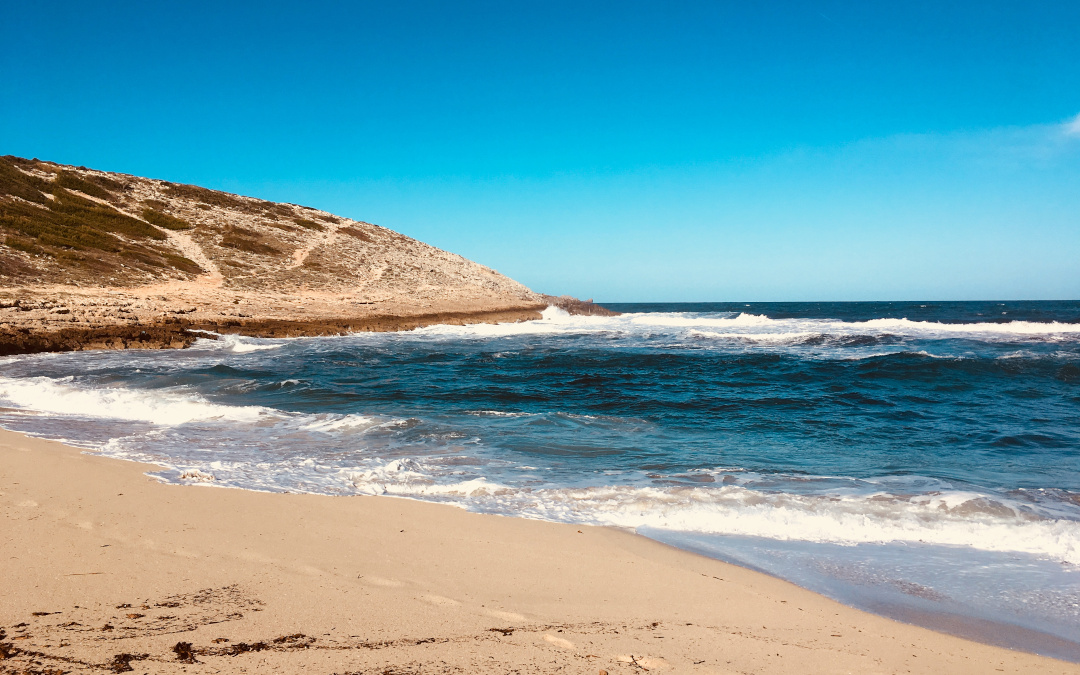
Cala Torta: During the trip we can observe a wild landscape that combines valleys and mountains. It is easy to spot the island of Menorca on clear days. At the end of the route there is a junction, the road to the right leads us to Cala Torta. We can also reach Cala Torta by foot or bicycle from Capdepera, through a 22 kilometres mountain route marked with red points that departs from Cala Mesquida. This cove opens to Tramuntane and Gregale winds and is located on the eastern end of Arta’s coastline, close to the limit with Capdepera. It has a 200 feet wide beach of thick sand that penetrates to the interior drawing a strong curve, which probably gives its name – Torta means crooked. Sometimes, the torrent floods the end of the beach, creating a small lake. Cala Torta has Arta’s mountain range in the background, here with lower vegetation and pine trees. The sea horizon is presided over by the silhouette of Faralló d’Albarca islet. The sand beach rises three metres over the sea, creating a big unevenness on the seashore, where algae accumulates due to the storms. The eastern shore is high and with a cliff, but the western shore is small and shaped by Gregale and Levant winds. Vegetation is lower here. At the end of the beach, from one side to the other of the cove, a small dune system develops delimiting the torrent with sea lilies and shrubs combed shaped by salinity and wind.
Es Caló: It is surrounded by ochre sandstone cliffs lightly drawn towards the sea. On the top, there is a pine forest with palm trees and treelike prickly pears on its bottom that go up to the same cliff. Furthermore, on the cliff’s foot we find big pine trees growing in the sandstone. A pier demolished by storms, before with a lighthouse on its end, protects the bay from Levant. Before its construction, Alcudia people hosted a tunna fishery here. It is also known as Caló de Betlem. In fact, we must get to the urbanization of Betlem to arrive to es Caló. Heading through the main road, we cross the urbanization up to a stone lane where we shall leave the vehicle and continue, by foot or bicycle, along the route beside the coast. A 25 minutes walk to the cove.
Cala Mitjana: During the trip we can observe a wild landscape that combines valleys and mountains. It is easy to spot the island of Menorca during atmospheric clear days. At the end of the route there is a junction, the right one leads us to Cala Torta and the left heads to our destination, Cala Mitjana. Anchoring boats is difficult due to the shallowness. This sea entrance opens to the Mediterranean Gregale wind. Sited between Cala Estreta and Cala Torta, Cala Mitjana has a fine sand beach of 120 feet long with small dunes. Although it has fine sand, it can be considered thicker than the sand from the South-eastern beaches of the island. Its shore is low with scanty vegetation, softly inclined to the sea and shaped by it on the West side. Its vegetation, very damaged due to salinity, is formed by, basically, pine trees, shrubs and palm trees, as well as some donardes or atzavares –the ornamental plant known as Agave americana. Its name is given for a simple reason: this sea entrance is the middle in a succession of three equidistant coves -Mitjana means medium.
Caloscamps: The name of Caloscamps (cove of the countries) is obviously given by the cultivated lands found beside the cove, clearly drawn in old cartographies. The cove, excavated in fossil dunes by the torrent and sea erosion, combines sand and stone areas and is surrounded by tamarinds that grow by the sea shore, providing a nice shade. Some years, the beach is covered with the Mediterranean marine plant known as Posidonia. A beach with an interesting environment of flora, fauna and heritage. We can see remains of an old bunker, a boathouse, a quarry and some archeological sites like the talayots of Can Pa amb Oli.
Es Matzoc: The defence tower, dated from the 17th century, guarded the British island of Menorca and still preserves its cannon. Originally, it was called San Fernando Tower. Es Matzoc combines fine sand and stones. It is orientated to the East, between Albarca Tower and Cala Dentola. It is seaworthy, with sand bottom and seaweed penetrating in diagonal fringes. Its shore declines towards the sea and is covered with fossil dunes in some parts. We find dense pine forests that stretch down to the beach, where two torrents merge excavating a canal as they run into the sea. The bed of the main torrent is flat, like an avenue. Along its banks palm trees and alics –Vitex Agnuscastus– grow. We can also find some example of the endemic plant Pastinaca Lucida. We get here by foot and the shortest way is made through the area of sa Duaia, departing from Cala Estreta to take the old route of Carabiners (coast guards) that arrives to Es Matzoc.
Font: www.artamallorca.travel